Stormwater Management at Public Boat Ramps
- Home
- /
- Stormwater Management at Public Boat Ramps


Boat Ramp Stormwater Management
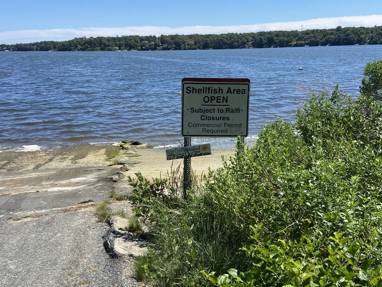
Freshwater ponds and coastal embayments across Cape Cod are significantly degraded by nutrient and bacteria impairment. Land uses, including stormwater runoff and fertilizer use, contribute on average 20 percent of the controllable nitrogen load within our coastal watersheds, and bacterial contamination including cyanobacteria blooms regularly causes closures of shellfish areas and beaches.
The Cape Cod Boat Ramp Stormwater Project aims to address this issue through stormwater management at public boat ramps, locations of direct discharge with little to no treatment of stormwater. The goal of this project was to complete a regional assessment and prioritization to inform development of designs for improved stormwater management at priority boat ramp sites. Designs emphasize the use of green stormwater infrastructure that utilize soils and native plants for pollution removal to maximize nutrient and bacteria reduction to improve water quality.
APCC is managing this project working with state and municipal staff along with local pond and watershed associations, businesses, residents, and community groups associated with high priority sites to inform planning, design, and construction. In partnership with APCC and local towns, Horsley Witten Group (HW) has made significant progress on 10 of 20 priority sites. This includes advancing 2 sites to construction and 8 sites to permit-ready design. HW is providing stormwater engineering services, including assessment, design, permitting, and construction oversight. APCC plans to work with our partners to leverage further support and funding for design, construction, and installation of stormwater systems at these priority sites.
Priority Boat Ramps
The interactive map below shows the initial high-priority boat ramps selected with input from town and state staff for improved stormwater management designs. Additional layers from MassGIS indicate the level of water quality impairment, presence of native anadromous fish species, and watershed drainage areas at the associated ponds and embayments. By clicking on the individual boat ramp symbols, you can learn more about each site. Also, toggle layers on and off to investigate the resources and impairments at each location.
The project area includes freshwater ponds and coastal embayments in Barnstable, Bourne, Brewster, Dennis, Falmouth, Harwich, Mashpee, Orleans, Sandwich, and Yarmouth.
The project began in late 2021 with identification of potential sites. Over 100 public boat ramps (town and/or state owned) were identified within the project area. With input from municipal and state partners, the top 20 boat ramp sites were selected for further assessment and design. Site visits were completed in July 2022 to inform concept designs and prioritization of these 20 sites. From this list a subset of priority sites was selected for development of permit-ready designs by end of 2023, and APCC and the project teams are continuing to work to advance these and other priority sites toward implementation.
10% Concept Designs & Field Forms
Horsley Witten Group and APCC met with state and town staff members at each site in July 2022 to assess the drainage area, facilities, and existing conditions of each boat ramp. Based on the field visits, Horsley Witten developed “Field Forms (PDF)” summarizing the observations of current conditions as well as conceptual design sketches of proposed stormwater best management practices.
- Project introduction meeting (June 2022)
- Concept Design Public Meetings (November 2022)
Priority Sites Advanced through Design
Since the comments we received from the public engagement process were so supportive of the project goals and concept designs, we were able to select the top sites advancing to the next phases of design based largely on the prioritization generated from ranking the sites according to the following criteria:
- Potential Pollution Removal (40 pts)
This category was allotted the highest number of possible points based on the main project goal of addressing the pollutants of concern. We analyzed this category based on water quality volume treated (with a goal of 1 inch per impervious acre), as well as the most currently accepted removal efficiencies for the proposed practices. - Estimated Planning-Level Construction Cost (10 pts)
Preliminary planning-level construction cost estimates were roughly approximated on a unit cost per volume or area of the practice and any associated infrastructure based on literature and HW’s recent experience with implementation of local projects. - Ease of Implementation (20 pts)
Compared the concept designs based on implementation factors, such as potential required permitting, construction access, potential abutter property impacts, and maintenance burden. - Additional benefits/factors (30 pts)
This category compared the concept designs based on additional factors of interest including proximity to environmental justice populations and resource areas (e.g., shellfish beds and anadromous fish runs), improving habitat (e.g., removing invasive species), addressing existing conditions (e.g., repaving degraded ramps), building climate resiliency (e.g., adding wind or wave breaks), and providing public education.
Based on the ranking and conversations with local partners, the following sites were selected to advance to 25% and 75% (permit ready) design. These projects will continue to be advanced to permitting and construction as funding and feasibility align in the future.
25% Designs
Permit-Ready (75%) Stormwater Retrofit Designs
Throughout 2023, APCC and Horsley Witten Group worked closely with town and state staff, as well as local stakeholders, on the design of green stormwater infrastructure retrofits for the seven priority locations (eight sites). To access the permit-ready site plans and stormwater report (including Operations and Maintenance Guide), see the links below for each site. Permitting for these sites was completed in 2024. For a summary of the project through the end of 2023 see: APCC’s EPA Southeast New England Program Grant Report Executive Summary.
- Electric Avenue Boat Ramp (Bourne)
- Scargo Lake Landings – 2 sites (Dennis)
- Ashumet Pond Boat Ramp (Falmouth)
- Herring River Boat Ramp (Rt 28, Harwich)
- Mashpee-Wakeby Pond Boat Ramp (Mashpee)
- Oak Crest Cove Boat Ramp (Sandwich)
- Follins Pond Road Boat Ramp (Yarmouth)
For those sites that were not selected for further design as part of this current funding cycle, APCC will continue to work with interested partners to seek additional funding to develop stormwater designs for these remaining sites. Additionally, APCC has shared all acquired stakeholder feedback regarding these other sites with the respective state or town partners for future planning.
Final Design and Construction
With funding from the Massachusetts Office of Coastal Zone Management Coastal Habitat and Water Quality Grants and APCC private foundation funding, Follins Pond, Scargo Lake, and Mashpee-Wakeby sites were advanced to 95-100% design in 2024. The CZM CHWQ FY24-25 Grant has also funded the construction of green stormwater infrastructure at the two landing sites on Scargo Lake in Dennis. Construction is expected to be completed by spring of 2025. The Ecosystem Restoration Program continues to work toward funding and completing work at Follins Pond and Mashpee-Wakeby Pond, as well as additional priority sites identified through this project. See final design site plans below:
- Scargo Lake Landings (Dennis)
- Mashpee-Wakeby Pond Boat Ramp
- Follins Pond Road Boat Ramp
Project Funding
Funding for this work has been provided by a U.S. Environmental Protection Agency Southeast New England Program Watershed Grant in partnership with Restore America’s Estuaries (FY21), two MA Office of Coastal Zone Management Coastal Habitat and Water Quality Grants (FY23 and FY24), private foundation funding, in-kind contributions from state and municipal staff, and the MassBays National Estuary Partnership.
Partners
This project is a collaborative effort with the Massachusetts Department of Fish and Game Office of Fishing and Boating Access and the following towns: Barnstable, Bourne, Brewster, Dennis, Falmouth, Harwich, Mashpee, Orleans, Sandwich, and Yarmouth.