Yarmouth Stormwater
- Home
- /
- Our Work
- /
- Science
- /
- Stormwater Management
- /
- Yarmouth Stormwater

Beginning in 2023, APCC began working with the town of Yarmouth and Horsley Witten Group to complete an initial stormwater management plan. This work included the assessment, prioritization, and development of concept designs to address runoff in priority areas south of Route 6. The purpose of this project is to build upon ongoing efforts to improve coastal water quality in the town of Yarmouth by reducing or eliminating pollutant loadings from stormwater runoff nonpoint source pollution.
This project focusses on identifying stormwater discharge connected directly to surface waters or coastal embayments where we can achieve the greatest reduction in pollutant loadings, especially nitrogen, bacteria, and sediment. These stormwater retrofit sites have been assessed and prioritized with the goals to:
- improve water quality;
- improve habitat for shellfish, fish and wildlife; and,
- restore areas for designated human uses, including shellfishing, fishing, and swimming.
Project initiatives for retrofit designs include a focus on green infrastructure stormwater Best Management Practices (BMPs) and low impact design.
Project Area
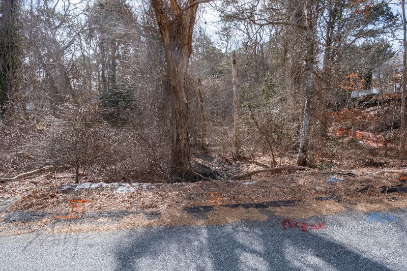
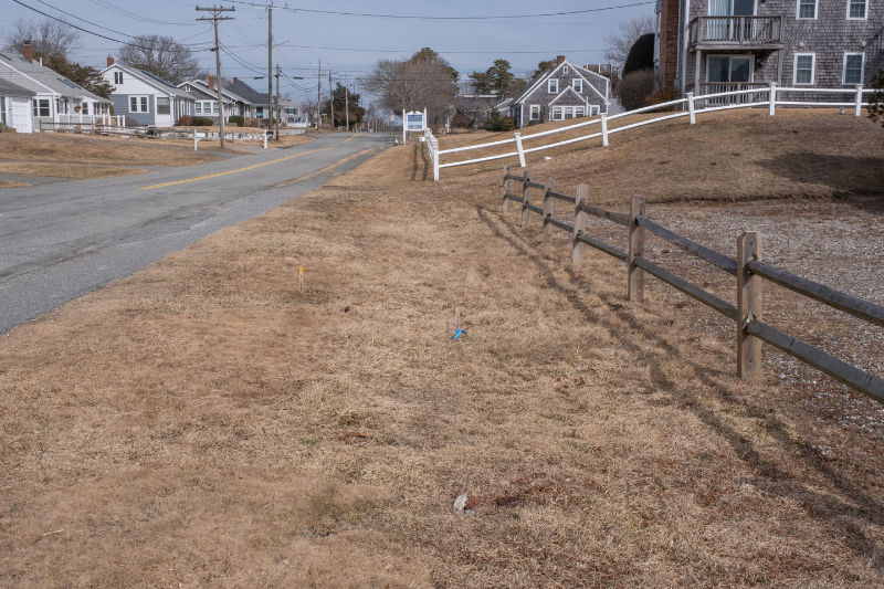
The project area is located within the town of Yarmouth, south of Route 6, which discharges to Nantucket Sound, including Lewis Bay, Mill Creek, Parkers River, Lewis Pond, Seine Pond, Long Pond, and areas west of Bass River.

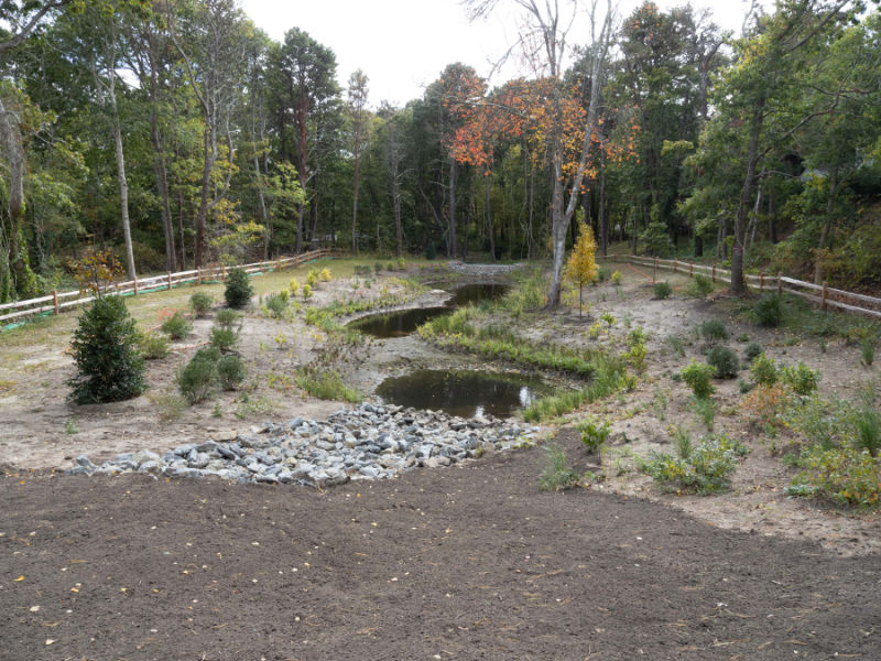
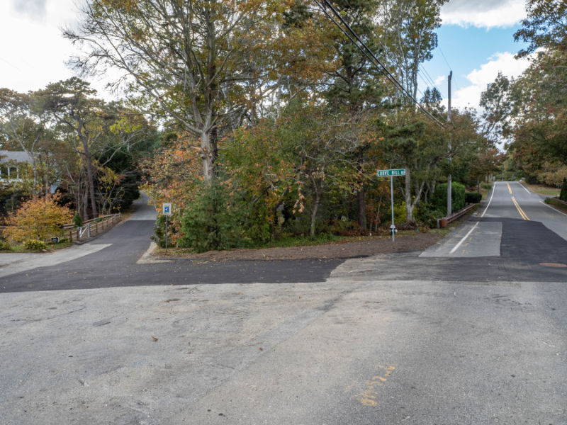
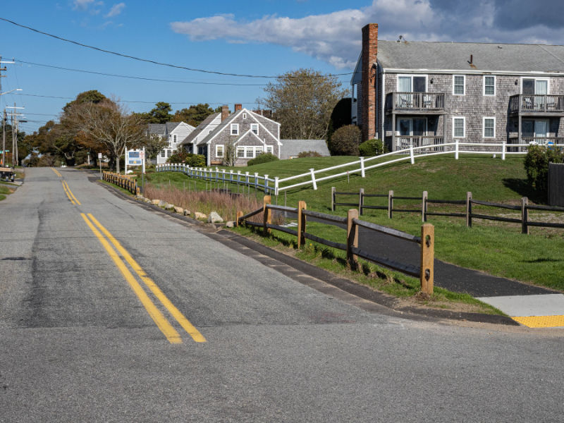
Map of the project area showing the sites assessed under this project, and the top 10 concept designs selected by the public and the project team. Of these sites, Baker Ave (MC-5), Curve Hill Rd (UBR-4), Grove Street (HIH-3), Lake Road West (PR-3 and PR-4), and Standish Way (MC-3) were advanced to 25% design. Construction at Curve Hill Road and Standish Way was completed in 2025.
Timeline
2023 — Planning & Concept Design
- Developed a comprehensive stormwater management plan for South Yarmouth
- Completed site assessments, retrofit prioritization, and 10% concept designs to guide future implementation
2024 — Design Advancement & Permitting
- Selected six stormwater retrofit sites for 25% design
- Advanced the top two sites to 75% design (August 2024): Standish Way and Curve Hill Road
- Permits approved by the Yarmouth Conservation Commission (October 2024)
- Final design completed by late 2024, with construction scheduled for early 2025
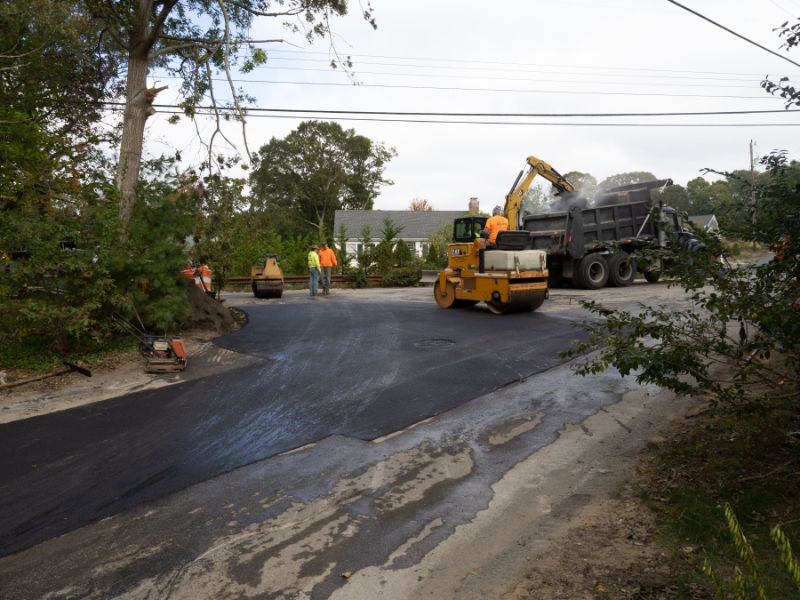
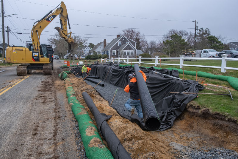
2025 — Construction & Field-Driven Refinements
- Began construction of the top two sites in early 2025 (Standish Way and Curve Hill Road)
- During construction, an additional need was identified: replacement of drainage pipes/structures to improve stormwater flow from Great Western Road to the new Curve Hill Road wetland
- Construction at Great Western Road was completed in October 2025
2025–2026 — Next Sites in Progress
- Advancing Wings Grove Beach and Old Main Street from site assessment through 75% design
- Completing permitting and final design for Grove Street by June 30, 2026
- Construction to follow once funding is secured
Public meeting information
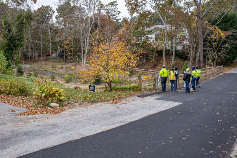
An important part of this project has been public input on site prioritization and design. Public meetings were held to introduce the project in 2023, and to review the sites advanced to 25% design in 2024. The input from the public and stakeholders helped the team to decide which sites to advance to permit-ready and final design phases.
- 2023
- Recording of the public meeting held June 13, 2023 to introduce the project and review concept designs for top ranking sites
- 2024
- The project and the 25% design site plans were presented at a public meeting on June 12, 2024
Design Documents and Reports
25% Design Plans
Based on the ranking and conversations with local partners, the sites selected to advance to 25% design plans are:
- Baker Ave (MC-5) – Design Plan (PDF)
- Curve Hill Rd (UBR-4) – Design Plan (PDF)
- Grove Street (HIH-3) – Design Plan (PDF)
- Lake Road West (PR-3, and PR-4) – Design Plan (PDF)
- Standish Way (MC-3) – Design Plan (PDF)
Final Design and Reports
With public input from the June 2024 public meeting, the following sites were selected to advance to through design and implementation. The 75% design plans and stormwater reports were prepared for the local permitting process.
For Curve Hill Road and Standish Way: both projects were approved by the Yarmouth Conservation Commission in October 2024, with final design plans by end of 2024 and construction completed in 2025.
- Curve Hill Rd (UBR-4) 100% Design Plans (PDF), Stormwater Report (PDF)
- Standish Way (MC-3) 100% Design Plans (PDF), Stormwater Report (PDF)
- Great Western Rd – 100% Design Plans (PDF)
- Yarmouth CZM FY24 Final Report
Project Funding
Funding for this work has been provided by the town of Yarmouth and the Massachusetts Office of Coastal Zone Management Coastal Habitat and Water Quality Grants. Funding for the construction at Standish Way will also be provided by USDA Natural Resources Conservation Service in coordination with the Cape Cod Conservation District.
Partners
This project is a collaborative effort between the town of Yarmouth, APCC, and Horsley Witten Group. The Natural Resources Conservation Service and the Cape Cod Conservation District have provided additional expertise and collaboration on development of the site plans for Standish Way.