Weir Creek Tidal Restoration
Salt marsh ecosystem services benefit the community
Tidal marshes are vital ecosystems on Cape Cod. A healthy salt marsh is important for coastal resiliency – the ability for a coastal region to recover from storms and adjust to sea level rise. These marshes protect inland areas from storm damage and flooding by physically buffering wave action and acting like a sponge to absorb floodwater.
Tidal restrictions impair services and degrade upstream habitat
Tidal restrictions, such as road crossings, that constrain normal ebb and flood patterns can negatively impact the health of a salt marsh by disrupting the natural mechanisms needed to maintain marsh elevation, sustain nutrient cycling and uptake, and promote growth of native salt marsh grasses. As a result, the integrity of the soil and plants become impaired. Under these depleted conditions, the salt marsh can no longer effectively buffer the surrounding community from extreme flooding. In fact, tidal restrictions make flooding worse by holding back water during and after large storm events, increasing and prolonging flood risk to the surrounding community.
Tidal restrictions also impair water quality by reducing the flushing capacity of the system, leading to habitat degradation for fish, shellfish, birds, and other wildlife.
By removing tidal restrictions or widening undersized pipes and culverts, we can reverse these impacts and restore the salt marsh’s ability to reduce flood risk, improve water quality, and support greater biodiversity.
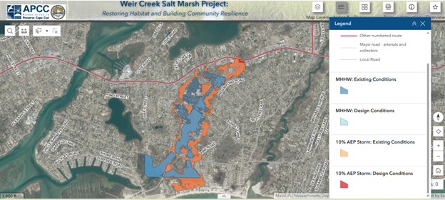
The Weir Creek Tidal Viewer
The Weir Creek Tidal Viewer was developed by Tighe & Bond in collaboration with the APCC and Woods Hole Group with input from the full team of project partners. The Tidal Viewer allows users to visualize peak tide heights during normal daily tides (mean higher high water, or MHHW) and during a storm with a 10% annual exceedance probability (AEP). The Viewer is hosted within a StoryMap application which provides background and context for the restoration project.
Project Scope and Timeline
The aim of the Weir Creek salt marsh and community resilience restoration project is to replace the two undersized culverts along Lower County Road with larger box culverts to improve the upstream marsh function and reduce the flood risk to the surrounding community.
Starting in 2023, APCC and the town of Dennis have been working closely with project partners and consultants at Tighe & Bond and Woods Hole Group. Data collection and hydrodynamic modeling were completed in summer 2023 and spring 2024, respectively. The modeling was used to assess water flow (flooding extent and velocity) through new enlarged culverts under various storm and sea level rise scenarios. Alternative culvert designs were considered to maximize salt marsh habitat restoration and minimize negative impacts of flooding on nearby low-lying properties.
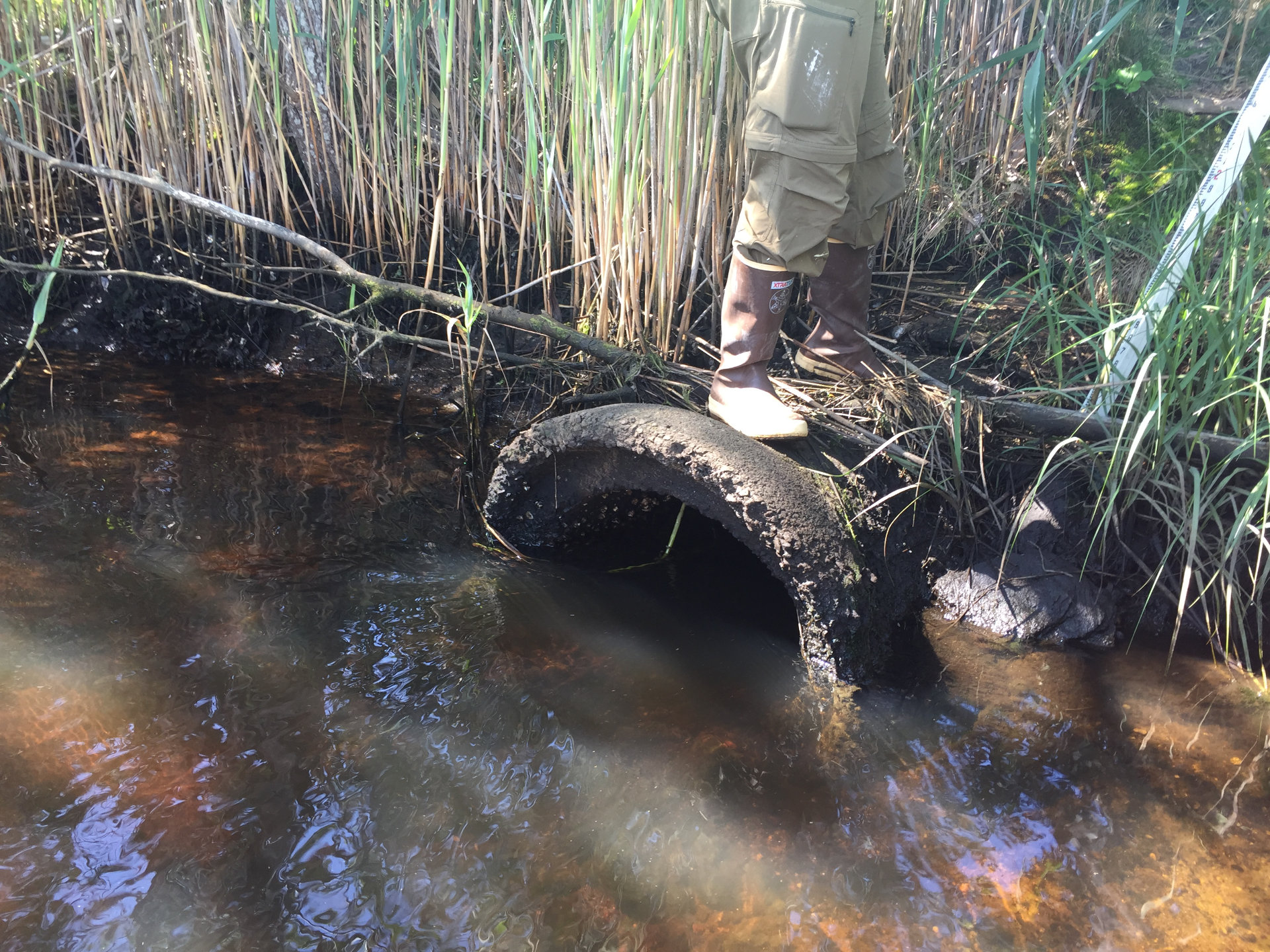
In 2024, APCC collected baseline water quality (including a suite of nutrient parameters), elevation, vegetation, salinity, and water level data as part of an extensive monitoring program that was funded by the Cape Cod Conservation District and a private foundation. These data will be used to inform development of an adaptive management plan.

Public engagement
It is important to receive input from the community on projects that impact the local environment and infrastructure. A series of public meetings will be held throughout the project to share updates with the community. These public meetings are also an opportunity for the project team to gather input and receive feedback about the proposed restoration from community members.
To receive updates on the Weir Creek project and notices of public meetings, please fill out the form below:
Sign Up
Below are links to presentations and recordings of previous public meetings:
Public Meeting One – June 15, 2023
Public Meeting Two (Early 2024)
Public Meeting Three – August 20, 2025
- Zoom Meeting Recording
- APCC and Tighe & Bond Presentation Slides
(project benefits, tidal hydrology modeling, and design plans) - Weir Creek Tidal Viewer
Additional Project Materials
- Tighe & Bond 30% Culvert/Roadway Designs
- Woods Hole Group Hydrodynamic Model & Alternatives Analysis
- Woods Hole Group Flood Path Memo
- Woods Hole Group Inlet Stability Memo
- Woods Hole Group Lighthouse Road Flooding Memo
- Woods Hole Group Loring Ave & Shoal Removal Memo
- Frequently Asked Questions (All)
- Frequently Asked Questions
The Weir Creek salt marsh and community resilience restoration project
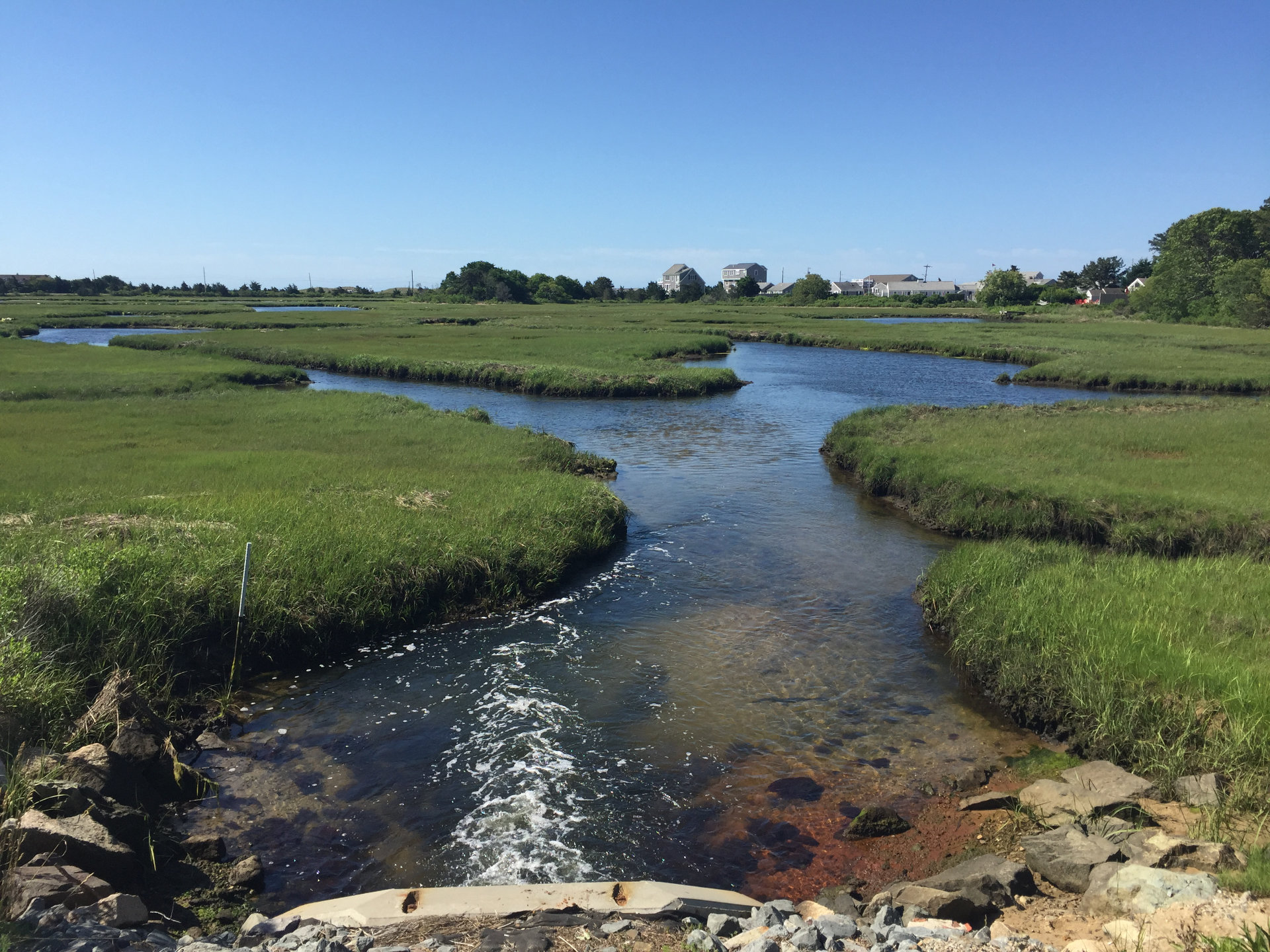
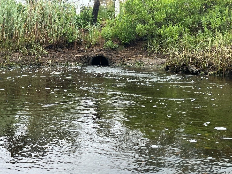
The Weir Creek salt marsh, located on the southern coast of Dennis, MA, is partially restricted by two undersized culverts (or pipes) under Lower County Road. These culverts provide a route for tidal waters to flow in from the Bass River on the incoming tide, and flow back out on the outgoing tide. However, the culverts are a fraction of the size of the natural channel, impeding the extent of flood tides and slowing drainage during ebb tides.
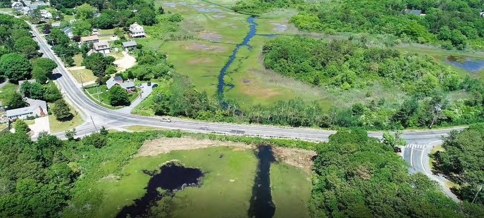
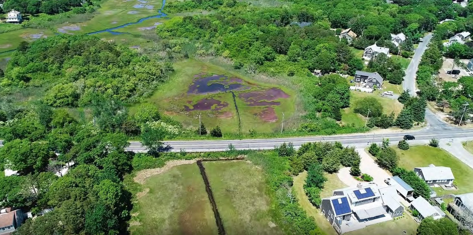
Aerial photos of the two areas along Lower County Road in Dennis, MA, where undersized culverts are disrupting the natural tidal flow patterns along the main channel of Weir Creek to the west and north of Uncle Stephans Pond to the east.
Reduced flood tides and slow drainage lead to several significant problems. Three of the main concerns are provided below.
1) Prolonged flooding of abutting properties
When the tide recedes after an extremely high tide or a storm, water becomes bottlenecked at the Lower County Road culverts for an extended period of time, risking damage to property, infrastructure, and road access. Thus, the capacity of these restricted marshes to buffer inland areas from sea level rise and storm surge has been greatly reduced. By expanding the size of these culverts, the drainage rate of high flood waters will improve, and the risk of property damage associated with storm surge can be reduced.
2) Spread of invasive plants
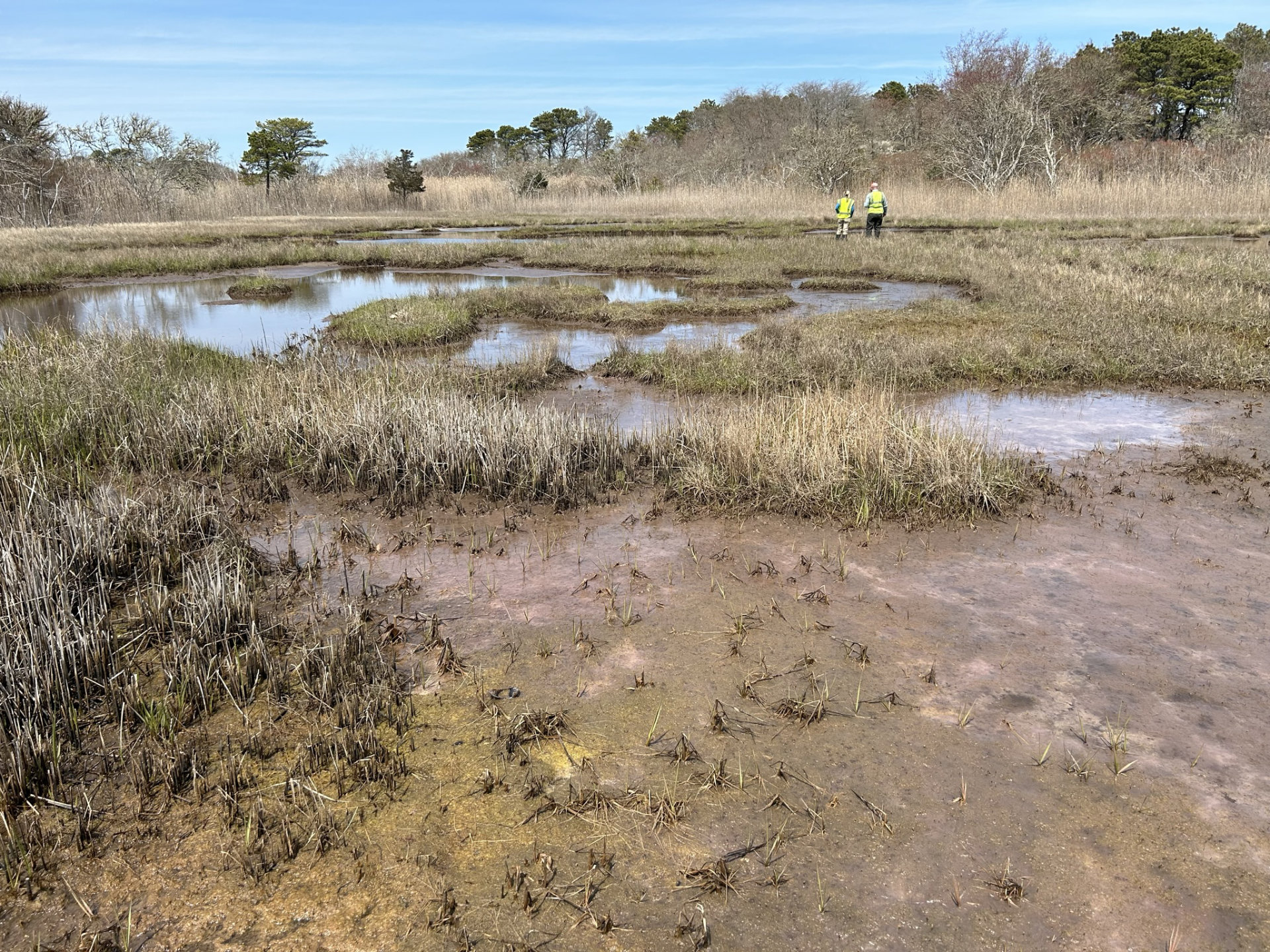
The reduction in saltwater tidal flow has changed the upstream salinity gradient and affected the marsh plant species composition. Native salt marsh grasses possess a physiological adaptation to withstand the stress of frequent saltwater flooding. However, when the conditions no longer require these adaptations, the extent of salt marsh plants is constrained and can allow the invasive plant species, Phragmites australis (common reed), to take advantage of the fresher conditions. Large stands of this invasive plant have been shown to negatively impact fish and bird species by limiting the diversity and accessibility of insects and other food sources. When the natural tidal flow is restored, the conditions can be reset to help promote more native plant growth and a more robust habitat and healthy ecosystem supporting fish, shellfish, birds and other wildlife.

3) Proliferation of disease-carrying mosquitoes
Stagnant freshwater is the perfect habitat for breeding disease-carrying mosquitoes. The majority of the mosquito-borne diseases present in Massachusetts (including Eastern Equine Encephalitis, EEE, and West Nile Virus) are carried by mosquitoes that breed in freshwater, not saltwater. Currently, the Cape Cod Mosquito Control Project (CCMCP) regularly visits the Weir Creek salt marsh to prevent an outbreak of mosquitoes that could lead to significant public health concerns. The CCMCP prefers the option of reducing breeding sources as opposed to applying larvicide. By reintegrating the salt marsh’s natural tidal hydrology, reestablishing a gradual salinity gradient across the upstream system, and draining large pools of standing water, mosquito populations could be controlled without the use of larvicide applications. Since the tidal restoration at Weir Creek will reduce the area of breeding pools, the CCMCP are active partners in the project.

Map of the Weir Creek restoration project area. Note the constrained area of salt marsh habitat upstream of the two culverts on Lower County Road as indicated by the outline of estuarine and marine wetland. The two undersized culverts which are the focus of this project are indicated by stars and labeled DE-5 and DE-6.

Project Partners
APCC is managing this project in collaboration with the town of Dennis, Tighe & Bond, Woods Hole Group, the USDA Natural Conservation Resources Service, the Cape Cod Conservation District, Friends of Bass River, Cape Cod Mosquito Control Program, the Dennis Conservation Land Trust, and the Cape Cod Commission.
Funding
Funding and support of this project is provided by the Cape Cod Conservation District under the Cape Cod Water Resources Restoration Project, the National Fish and Wildlife Foundation National Coastal Resilience Fund, the Southeast New England Program (SNEP) Watershed Implementation Grants administered by the U.S. Environmental Protection Agency through collaboration with Restore America’s Estuaries, the NOAA Restoration Center, U.S. Department of Commerce Transformational Habitat Restoration Grant, the town of Dennis, and a private foundation.